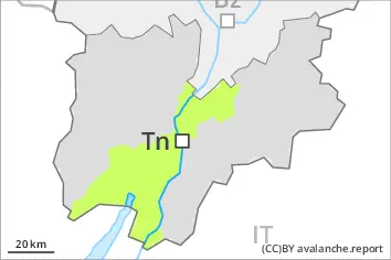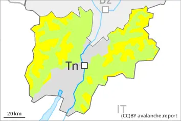
Danger level
 | 2000m |
|  |
|  | ||||
| |
|  |


![]()
Fresh wind slabs require caution. Weak layers in the old snowpack are treacherous.
Fresh wind slabs are to be evaluated with care and prudence in particular on very steep shady slopes above approximately 2000 m, especially adjacent to ridgelines. Restraint should be exercised because avalanches can sweep people along and give rise to falls.
Weak layers in the old snowpack can still be released in isolated cases by individual winter sport participants. The avalanche prone locations are to be found in particular on steep, little used west, north and east facing slopes above approximately 2400 m. Mostly avalanches are medium-sized. In isolated cases avalanches can also release deeper layers of the snowpack and reach large size.
Some small and, in isolated cases, medium-sized moist loose snow avalanches are possible in particular on steep southeast, south and west facing slopes. The danger will already exist in the early morning.
Snowpack
dp.6: cold, loose snow and wind
Over a wide area up to 10 cm of snow, and even more in some localities, will fall above approximately 2000 m. As a consequence of new snow and a strong to storm force wind from northeasterly directions, mostly small wind slabs will form by Sunday especially adjacent to ridgelines.
Precarious weak layers exist in the old snowpack especially on steep, little used west, north and east facing slopes.
The surface of the snowpack cooled hardly at all during the overcast night and will already be soft in the early morning.
Tendency
On Sunday the wind will be strong over a wide area. In addition wind slabs will form by the evening. The avalanche danger will persist.