Danger level
 | 1800m |
|  |
|  |

![]()
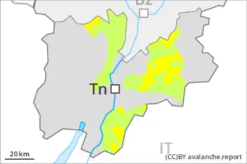
New snow and wet snow represent the main danger. The new snow and wind slabs of the last few days must be evaluated with care and prudence above approximately 2400 m.
The conditions are sometimes unfavourable for backcountry touring outside marked and open pistes. The more recent wind slabs are lying on the unfavourable surface of an old snowpack in particular on very steep west, north and east facing slopes above approximately 2400 m. Such avalanche prone locations are to be found in particular adjacent to ridgelines and in gullies and bowls.
In particular on very steep slopes and below approximately 2600 m numerous medium-sized and, in isolated cases, large moist and wet avalanches are possible as the moisture increases. In particular on very steep west, north and east facing slopes medium-sized to large moist and wet avalanches are to be expected.
In isolated cases, the avalanches can reach areas without any snow cover in steep gullies.
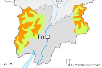
Snowpack
dp.10: springtime scenario
The rain gave rise to increasing and thorough wetting of the snowpack below approximately 2200 m. This situation will give rise to a loss of strength within the snowpack in particular on steep slopes.
In some regions 40 to 100 cm of snow, and even more in some localities, has fallen above approximately 2400 m.
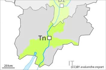
Tendency
Slight decrease in danger of wet avalanches as a consequence of the ceasing of precipitation. The surface of the snowpack will cool hardly at all during the overcast night will already be soft in the early morning. Wet snow represents the main danger. The new snow and wind slabs must be evaluated with care and prudence in high Alpine regions.