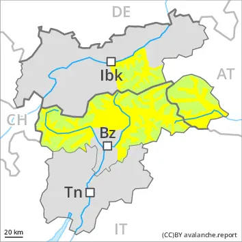
Wet snow requires caution. Wind slabs in the high Alpine regions.
The danger of wet avalanches will already exist in the early morning, in the event of solar radiation especially. In the afternoon the activity of wet avalanches will increase. In the event of rain this applies in particular. Mostly avalanches are only small. The avalanche prone locations are to be found especially on very steep west, north and east facing slopes below approximately 2600 m.
Fresh wind slabs can be released in isolated cases in particular on very steep shady slopes in high Alpine regions. Such avalanche prone locations are to be found especially adjacent to ridgelines and in gullies and bowls. Mostly avalanches are only small.
The Avalanche Warning Service currently has only a small amount of information that has been collected in the field, so that the avalanche danger should be investigated especially thoroughly in the relevant locality.
Snowpack
dp.10: springtime scenario dp.3: rain
The weather conditions fostered a stabilisation of the snow drift accumulations.
In some regions a partly clear night. The surface of the snowpack will only just freeze and will soften quickly. The old snowpack is wet. This applies on shady slopes below approximately 2600 m, as well as on sunny slopes below approximately 3000 m. Up to 2400 m and above rain will fall in the afternoon in some localities.
Tendency
In some regions a partly clear night. The surface of the snowpack will only just freeze and will soften quickly. The danger of wet avalanches will increase quickly in the early morning. Mostly avalanches are only small.
Danger level
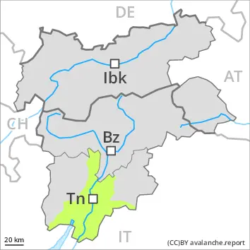
2500m
Avalanche Problem
Wind slab
2500m
Wet snow
2500m
2000m
Wind slabs at high altitude. Wet snow requires caution.
More recent wind slabs can be released by a single winter sport participant in some cases at elevated altitudes. Such avalanche prone locations are to be found adjacent to ridgelines and in gullies and bowls. Mostly avalanches are only small. Some snow will fall on Sunday in some regions. This applies especially above approximately 2500 m.
Wet avalanches can in very isolated cases be released by a single winter sport participant. Some rain will fall until Monday in some regions. This applies below approximately 2500 m. Natural wet avalanches are possible as a consequence of warming during the day. The avalanche prone locations are to be found especially on very steep west, north and east facing slopes below approximately 2500 m. Mostly wet avalanches are only small.
Snowpack
dp.10: springtime scenario dp.3: rain
The surface of the snowpack will cool hardly at all during the overcast night and will soften during the day. The old snowpack is wet and its surface has a crust that is not capable of bearing a load. This applies on shady slopes in particular below approximately 2500 m. Some snow will fall in some regions.
Tendency
The surface of the snowpack will freeze very little and will soften during the day.
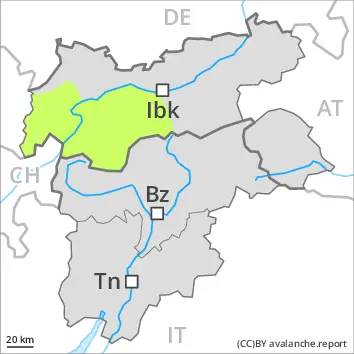
EARLIER Danger level
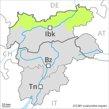
2600m
Avalanche Problem
Wind slab
2600m
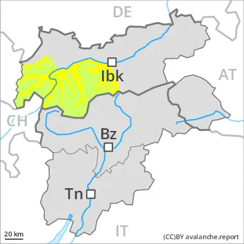
LATER Danger level
2600m
Avalanche Problem
Wet snow
2600m
Wind slab
2600m
The danger of wet avalanches will increase during the day. Wind slabs in the high Alpine regions.
As a consequence of warming during the day and the solar radiation, the likelihood of wet avalanches being released will increase. The avalanche prone locations are to be found especially on very steep west, north and east facing slopes below approximately 2600 m. In the afternoon the activity of wet avalanches will increase. In the event of rain this applies in particular. Mostly avalanches are only small.
Fresh wind slabs can be released in isolated cases in particular on very steep shady slopes in high Alpine regions. Such avalanche prone locations are to be found especially adjacent to ridgelines and in gullies and bowls. Mostly avalanches are only small.
The Avalanche Warning Service currently has only a small amount of information that has been collected in the field, so that the avalanche danger should be investigated especially thoroughly in the relevant locality.
Snowpack
dp.10: springtime scenario dp.3: rain
The weather conditions fostered a stabilisation of the snow drift accumulations.
In some regions a partly clear night. The surface of the snowpack will freeze to form a strong crust and will soften during the day. The old snowpack is wet. This applies on shady slopes below approximately 2600 m, as well as on sunny slopes below approximately 3000 m. Up to 2400 m and above rain will fall in the afternoon in some localities.
Tendency
In some regions a partly clear night. The surface of the snowpack will only just freeze and will soften quickly. The danger of wet avalanches will increase quickly in the early morning. Mostly avalanches are only small.
Danger level
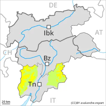
Low avalanche danger will prevail.
Only isolated wet avalanches are possible.
Snowpack
The surface of the snowpack will freeze very little and will soften during the day. The snowpack will be wet all the way through. A little snow is lying.
Tendency
Only isolated wet avalanches are possible.
Danger level
Wind slabs and wet snow require caution.
The danger of wet avalanches will increase during the day. Wet avalanches can in very isolated cases be released by a single winter sport participant. The avalanche prone locations are to be found especially on very steep west, north and east facing slopes below approximately 2600 m.
In the afternoon the activity of wet avalanches will increase. In the event of rain this applies in particular. Mostly avalanches are only small. The Avalanche Warning Service currently has only a small amount of information that has been collected in the field, so that the avalanche danger should be investigated especially thoroughly in the relevant locality.
Snowpack
dp.10: springtime scenario dp.3: rain
The weather conditions fostered a rapid stabilisation of the snow drift accumulations.
In some localities an overcast night. The surface of the snowpack has frozen to form a strong crust and will soften during the day. The old snowpack is wet. Up to high altitudes rain will fall in the afternoon in some localities.
Tendency
The surface of the snowpack will cool hardly at all during the overcast night. The danger of wet avalanches will already exist in the early morning. Mostly avalanches are only small.
Danger level
Low avalanche danger will prevail.
Only isolated avalanches are possible.
Snowpack
A partly overcast night. The surface of the snowpack will freeze very little and will already be soft in the early morning. The old snowpack will be wet all the way through. A little snow is lying.