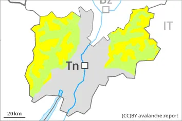
Danger level
 | 2400m |
|  |
|  | ||||
| |
|  |


![]()
The fresh and older wind slabs represent the main danger.
As a consequence of the strong to storm force northerly wind, fresh snow drift accumulations will form. This applies especially adjacent to ridgelines and in gullies and bowls. Fresh and older wind slabs are bonding poorly with the old snowpack. The wind slabs of the last few days are prone to triggering in all aspects above approximately 2400 m. The number and size of avalanche prone locations will increase with altitude.
Mostly avalanches are small.
In isolated cases avalanches can be triggered in the weakly bonded old snow. Such avalanche prone locations are to be found in particular on extremely steep shady slopes above approximately 2600 m.
In very isolated cases avalanches are medium-sized.
Even a small avalanche can sweep snow sport participants along and give rise to falls.
Snowpack
dp.6: cold, loose snow and wind
dp.1: deep persistent weak layer
The fresh and older wind slabs are lying on soft layers in particular on shady slopes above approximately 2400 m. In addition further wind slabs will form adjacent to ridgelines and generally in the high Alpine regions.
In particular shady slopes, above approximately 2600 m: Faceted weak layers exist in the bottom section of the snowpack.
The snowpack will be generally subject to considerable local variations.
Steep south facing slopes: Only a little snow is lying.
Tendency
The fresh and older wind slabs represent the main danger.

