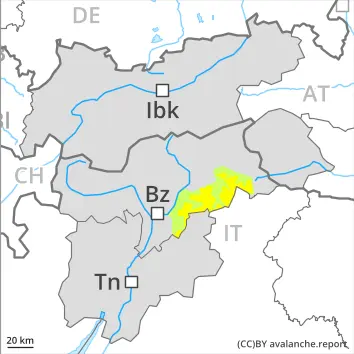
Increase in avalanche danger in the course of the day.
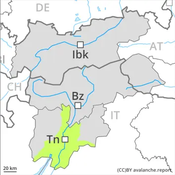
As a consequence of warming during the day and solar radiation there will be only a slight increase in the danger of wet avalanches. Wet avalanches can in isolated cases be released by a single winter sport participant, especially on very steep sunny slopes especially above approximately 2500 m, this also applies on very steep shady slopes below approximately 2500 m in gullies and bowls. In isolated cases avalanches are medium-sized.
As a consequence of warming during the day and the solar radiation, the likelihood of slab avalanches being released will increase gradually on very steep sunny slopes at high altitudes and in high Alpine regions, in the regions exposed to a lot of new snow especially. Moist loose snow avalanches are to be expected as the day progresses, even medium-sized ones.
Weak layers in the old snowpack can be released in isolated cases and mostly by large additional loads in particular on very steep shady slopes, in particular above approximately 2500 m.
Snowpack
dp.10: springtime scenario dp.1: deep persistent weak layer
In some localities 15 to 30 cm of snow, and even more in some localities, fell in the last two days above approximately 2600 m. Outgoing longwave radiation during the night will be good over a wide area. The surface of the snowpack will freeze to form a strong crust and will soften during the day.
Shady slopes above approximately 2500 m: Faceted weak layers exist in the bottom section of the old snowpack at elevated altitudes.
Below approximately 2000 m no snow is lying. Between approximately 2000 and 2500 m only a little snow is now lying, in particular on very steep shady slopes in gullies and bowls.
Tendency
A clear night will be followed in the early morning by favourable conditions generally. Gradual increase in danger of wet avalanches as a consequence of warming during the day and solar radiation.
Danger level
2600m
Avalanche Problem
Wet snow
2600m
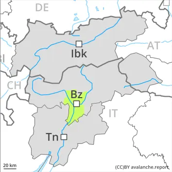
Wet snow requires caution.
As a consequence of new snow and wind, wind slabs formed in the last few days at high altitudes and in high Alpine regions. As a consequence of warming there will be a gradual increase in the avalanche danger. On very steep slopes the moist avalanches can be released naturally and reach medium size in isolated cases. Individual avalanche prone locations are to be found on very steep shady slopes above approximately 2600 m. Avalanches can be released, mostly by large loads and reach medium size.
Snowpack
dp.10: springtime scenario
Below approximately 2500 m a little snow is lying. The spring-like weather conditions will give rise to rapid moistening of the snowpack. The surface of the snowpack will only just freeze and will soften quickly. Steep west, north and east facing slopes above approximately 2500 m: Faceted weak layers exist in the bottom section of the old snowpack.
Tendency
The avalanche danger will persist.
EARLIER Danger level
LATER Danger level
2500m
Avalanche Problem
Wet snow
2500m
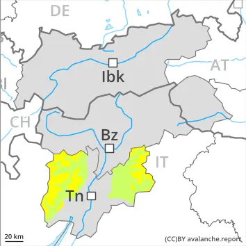
Increase in danger of wet avalanches in the course of the day.
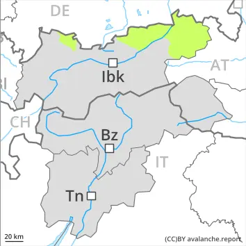
As the day progresses as a consequence of warming during the day and solar radiation there will be only a slight increase in the danger of wet avalanches. Wet avalanches can in isolated cases be released by a single winter sport participant, especially on very steep sunny slopes especially above approximately 2500 m, this also applies on very steep shady slopes below approximately 2500 m in gullies and bowls. In isolated cases avalanches are medium-sized.
As a consequence of solar radiation moist loose snow avalanches are to be expected as the day progresses, but they will be mostly small.
Weak layers in the old snowpack can be released in isolated cases and mostly by large additional loads in particular on very steep shady slopes, in particular above approximately 2500 m.
Snowpack
dp.10: springtime scenario dp.1: deep persistent weak layer
Outgoing longwave radiation during the night will be good over a wide area. The surface of the snowpack will freeze to form a strong crust and will soften during the day.
Shady slopes above approximately 2500 m: Faceted weak layers exist in the bottom section of the old snowpack at elevated altitudes.
Below approximately 2000 m no snow is lying. Between approximately 2000 and 2500 m only a little snow is now lying, in particular on very steep shady slopes in gullies and bowls.
Tendency
A clear night will be followed in the early morning by favourable conditions generally. Gradual increase in danger of wet avalanches as a consequence of warming during the day and solar radiation.
EARLIER Danger level
LATER Danger level
Avalanche Problem
Wet snow
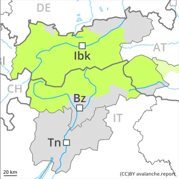
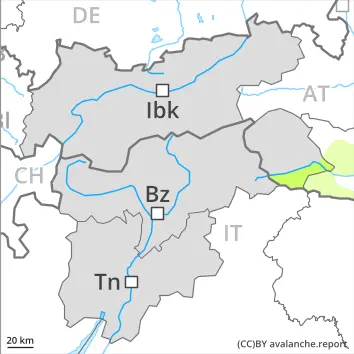
Individual avalanche prone locations for wet avalanches are to be found in particular on extremely steep shady slopes.
As a consequence of warming during the day and solar radiation individual mostly small wet avalanches are possible. This applies in particular in case of releases originating from extremely steep shady starting zones that still retain some snow.
Snowpack
dp.10: springtime scenario
The surface of the snowpack will freeze to form a strong crust and will soften during the day. On steep sunny slopes as well as below approximately 2000 m hardly any snow is lying.
Tendency
Low avalanche danger will prevail.
Danger level
Low avalanche danger will prevail.
The danger of moist and wet avalanches will already exist in the early morning. From origins in starting zones where no previous releases have taken place individual wet avalanches are possible, but they will be mostly small. Caution is to be exercised on extremely steep shady slopes.
Snowpack
dp.10: springtime scenario
Above approximately 2000 m thus far only a little snow is lying. This applies in gullies and bowls on shady slopes. Outgoing longwave radiation during the night will be barely evident over a wide area. The surface of the snowpack will soften quickly.
Tendency
Low avalanche danger will prevail.
Danger level
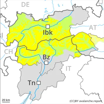
Wet snow requires caution.
The surface of the snowpack will freeze to form a strong crust. As a consequence of warming during the day and the solar radiation, the likelihood of wet snow slides and avalanches being released will increase a little.
Snowpack
dp.10: springtime scenario
The surface of the snowpack will freeze to form a strong crust will soften during the day. At low and intermediate altitudes hardly any snow is lying.
Tendency
Low avalanche danger will prevail.
Danger level
Only a little snow is lying.
Hardly any more wet avalanches are possible. Caution is to be exercised on extremely steep shady slopes. Avalanches are only small.
Snowpack
dp.3: rain dp.10: springtime scenario
The surface of the snowpack is frozen, but not to a significant depth and will soften quickly. Only a little snow is now lying.