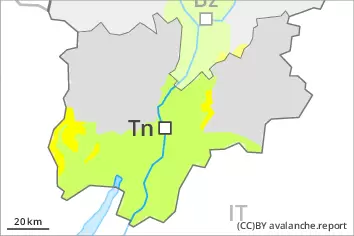
Danger level
 | 2200m |
|  |
|  |

![]()
Wind slabs represent the main danger.
The fresh wind slabs can be released easily in some places on very steep west, north and east facing slopes above approximately 2200 m. In high Alpine regions the avalanche prone locations are a little more prevalent and exist in all aspects. Avalanche prone locations are to be found in gullies and bowls, and behind abrupt changes in the terrain. Fresh wind slabs are to be bypassed as far as possible. Mostly avalanches are medium-sized.
As a consequence of solar radiation more small and, in isolated cases, medium-sized loose snow avalanches are possible, especially on extremely steep sunny slopes. In addition in particular in the regions exposed to heavier precipitation, individual gliding avalanches are possible.
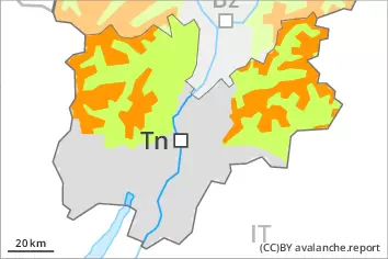
Snowpack
dp.6: cold, loose snow and wind
dp.2: gliding snow
On Sunday the wind will be strong in some cases in the regions exposed to the foehn wind. The wind will transport the new snow. The snowpack will be prone to triggering in some places. The various wind slabs have bonded poorly together, in particular on shady slopes at elevated altitudes.
Isolated avalanche prone weak layers exist in the old snowpack on very steep shady slopes, especially at elevated altitudes.
Tendency
Monday: The weather conditions will bring about a gradual strengthening of the snow drift accumulations.