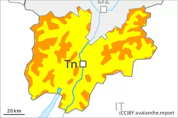
Danger level
 | treeline |
|  |
|  | ||||
|  |
|  |


![]()
Wind slabs represent the main danger. Gliding avalanches can also occur.
The new snow and wind slabs of the last few days remain for the foreseeable future prone to triggering in all aspects above the tree line. Avalanches can reach large size in isolated cases. The prevalence of the avalanche prone locations will increase with altitude. Caution is to be exercised in particular adjacent to ridgelines and in gullies and bowls, as well as in places that are protected from the wind. As a consequence of warming during the day and solar radiation more slab avalanches are possible as the day progresses, but they can be quite large. In addition medium-sized and, in isolated cases, large gliding avalanches and wet snow slides are possible, in particular on steep sunny slopes below approximately 2400 m.
Areas with glide cracks are to be avoided.
Snowpack
dp.6: cold, loose snow and wind
dp.10: springtime scenario
Some snow will fall on Wednesday in some regions. On Wednesday the wind will be moderate to strong at times. The new snow and wind slabs of the last few days are lying on soft layers above approximately 2200 m. Sunshine and high temperatures will give rise as the day progresses to moistening of the snowpack in particular at intermediate altitudes. The solar radiation will give rise as the day progresses to gradual moistening of the snowpack in particular on steep sunny slopes at intermediate altitudes. As a consequence of the occasionally strong wind, the snow drift accumulations have increased in size during the last few days.
Tendency
Gradual decrease in danger of dry avalanches as a consequence of warming during the day and solar radiation. Gliding avalanches and wet snow slides are possible on Thursday, even large ones in isolated cases.