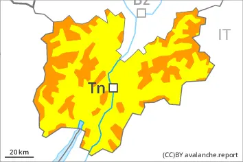
Danger level
 | treeline |
|  |
|  | ||||
| |
|  |


![]()
New snow and weakly bonded old snow represent the main danger.
Over a wide area 20 to 40 cm of snow, and even more in some localities, will fall until Thursday above approximately 1000 m. In addition the wind slabs of the weekend are prone to triggering still.
The fresh snow and the wind slabs are lying on top of a weakly bonded old snowpack on shady slopes above the tree line. Especially here avalanches can be triggered in the faceted old snow. This applies even in case of a small load. The avalanche prone locations are widespread and are barely recognisable.
Medium-sized and, in isolated cases, large avalanches are possible. Remotely triggered avalanches are possible. The number and size of avalanche prone locations will increase with altitude. Whumpfing sounds and the formation of shooting cracks when stepping on the snowpack and natural avalanches serve as an alarm sign. Weak layers in the old snowpack necessitate defensive route selection.
Snowpack
dp.5: snowfall after a long period of cold
dp.6: cold, loose snow and wind
Up to 30 cm of snow, and even more in some localities, has fallen since Saturday. As a consequence of a strong wind from southerly directions, soft wind slabs formed. These are lying on top of a weakly bonded old snowpack above the tree line. The old snowpack is faceted and weak. This applies especially in shady places that are protected from the wind. The old snowpack will be subject to considerable local variations.
Tendency
The current avalanche situation calls for caution and restraint.