New snow represents the main danger. Weakly bonded old snow requires caution.
As a consequence of new snow and a sometimes storm force wind from northwesterly directions, avalanche prone wind slabs formed. In the last few days the wind slabs have increased in size appreciably. The avalanche prone locations are to be found in all aspects above the tree line. This also applies in gullies and bowls, and behind abrupt changes in the terrain. The wind slabs can be released easily, even by a single winter sport participant,. As a consequence of the solar radiation, the likelihood of slab avalanches being released will increase. In some cases avalanches are large. The prevalence of avalanche prone locations and likelihood of triggering will increase with altitude.
As a consequence of solar radiation loose snow avalanches are to be expected from the late morning, in particular on very steep slopes.
Weak layers in the old snowpack can be released in very isolated cases by winter sport participants, especially on very steep shady slopes above approximately 2400 m. The avalanches can be released in the weakly bonded old snow and reach medium size.
Snowpack
dp.6: cold, loose snow and wind dp.1: deep persistent weak layer
Over a wide area 30 to 40 cm of snow, and even more in some localities, has fallen. This applies in particular in the west and in the north as well as in the High Tauern. As a consequence of the strong to storm force northwesterly wind, fresh snow drift accumulations formed during the last few days. In some cases the various wind slabs have bonded poorly together. Whumpfing sounds and the formation of shooting cracks when stepping on the snowpack indicate poor snowpack stability.
Faceted weak layers exist in the old snowpack, especially on shady slopes above approximately 2400 m.
Tendency
The danger of dry slab avalanches will persist. On Wednesday it will be very cloudy. Some snow will fall in some localities. The wind will be strong in some regions.
Danger level
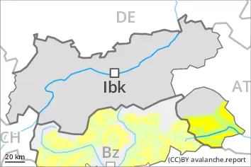
treeline
Avalanche Problem
New snow
Treeline
Persistent weak layer
2400m
New snow represents the main danger.
As a consequence of new snow and a sometimes storm force wind from northwesterly directions, avalanche prone wind slabs formed. In the last few days the wind slabs have increased in size appreciably. The avalanche prone locations are to be found in all aspects above the tree line. This also applies in gullies and bowls, and behind abrupt changes in the terrain. The wind slabs can be released easily, even by a single winter sport participant,. As a consequence of the solar radiation, the likelihood of slab avalanches being released will increase. In some cases avalanches are large. The prevalence of avalanche prone locations and likelihood of triggering will increase with altitude.
As a consequence of solar radiation loose snow avalanches are to be expected from the late morning, in particular on very steep slopes.
Snowpack
dp.6: cold, loose snow and wind
Over a wide area 30 to 40 cm of snow, and even more in some localities, has fallen. This applies in particular in the west and in the north as well as in the High Tauern. As a consequence of the strong to storm force northwesterly wind, fresh snow drift accumulations formed during the last few days. In some cases the various wind slabs have bonded poorly together. Whumpfing sounds and the formation of shooting cracks when stepping on the snowpack indicate poor snowpack stability.
Tendency
The danger of dry slab avalanches will persist. On Wednesday it will be very cloudy. The wind will be strong in some regions.
Danger level
2000m
Avalanche Problem
Wind slab
2000m
Persistent weak layer
2400m
Fresh wind slabs represent the main danger. Weakly bonded old snow is to be evaluated with care and prudence.
As a consequence of new snow and a strong to storm force wind from northwesterly directions, sometimes avalanche prone wind slabs formed. They are to be evaluated with care and prudence in particular in steep terrain. The avalanche prone locations are to be found in gullies and bowls, and behind abrupt changes in the terrain above approximately 2000 m. The prevalence of avalanche prone locations and likelihood of triggering will increase with altitude. Avalanches can reach medium size. Dry avalanches can additionally in isolated cases be released in the weakly bonded old snow also, especially on very steep shady slopes above approximately 2400 m. In isolated cases avalanches can penetrate even deep layers. Meticulous route selection is recommended.
Snowpack
dp.6: cold, loose snow and wind dp.1: deep persistent weak layer
Over a wide area 10 to 20 cm of snow has fallen. As a consequence of the strong to storm force northwesterly wind, fresh snow drift accumulations formed during the last few days. In some cases the various wind slabs have bonded poorly together. As a consequence of the strong wind the wind slabs will increase in size additionally on Tuesday. Faceted weak layers exist in the old snowpack, especially on steep shady slopes above approximately 2400 m.
Tendency
Over a wide area strong northwesterly wind. The weather conditions will bring about a very slow stabilisation of the snow drift accumulations.